
Post-medieval
In 1785, the MacFarlanes were forced to sell their lands to help pay their debts, and today, most of the land around the three villages is owned by Luss Estates Company.
The MacFarlanes: They had a reputation – rightly or wrongly – as enthusiastic cattle rustlers, who would hide their booty in the mountains near Loch Sloy in the dead of night, hence the clan's battle cry of 'Loch Sloy!' and the local name for the moon of 'MacFarlane's lantern'. However, the villages also saw signs of more peaceful cattle trading, with busy droving routes passing across the isthmus through Arrochar, Tarbet and Succoth from the west and around the head of Loch Long, aiming for the cattle fairs, or 'trysts', at Falkirk and Dumbarton. These traditional routes were later exploited by General Wade and his colleagues who were charged with building a road system throughout the Highlands to allow the easy movement of English troops, following the defeat of Bonnie Prince Charlie and his Jacobite army at Culloden in 1745.
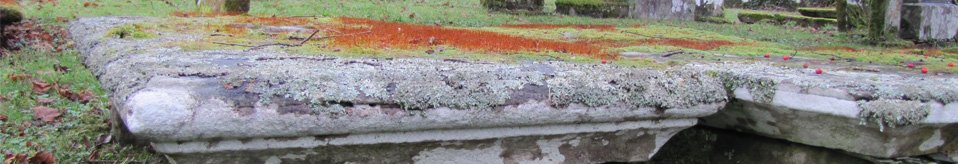
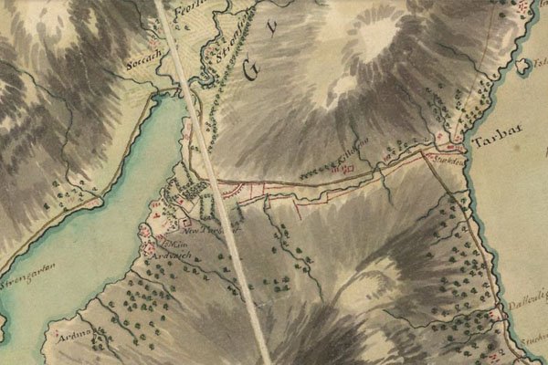
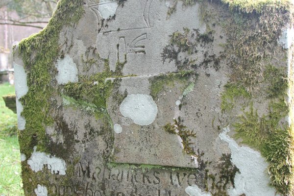
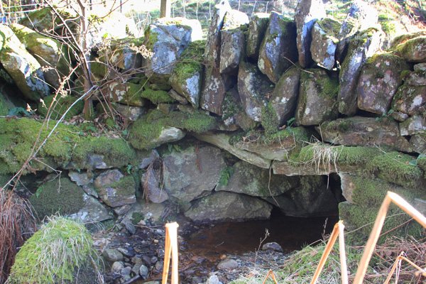
Ballyhennan Burial Ground: There is an old burial ground at Ballyhennan half-way across the isthmus, which pre-dates the church now located beside it. The graveyard is marked on Roy's map (1750) as 'Kilchenn' and there are no gravestones dated earlier than the mid-1700s. However, Fraser, in The Chiefs of Colquhoun and their Country, suggests that parishoners of the northern district of Luss and Arrochar were buried there before Arrochar was disjoined from Luss in the 17th century. Click on Canmore Ballyhennan Burial Site page for more information and here for a plan of the site, with access to photographs of the individual gravestones. One gravestone, undated, is dramatically different from the others, and may date to the 1500s. Click here to find out more about it.
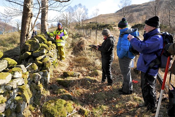
Deserted Rural Settlements: The hillsides around Loch Long and Loch Lomond bear testament to the many, small communities that used to live here. Please see our previous community-led High Morlaggan Project for more information. A few tumbled walls are now all that remain of settlements on the isthmus such as Creag an't Searraich and Tigh Vectican, whose inhabitants abandoned their cottages and self-sufficient lifestyles in favour of towns and cities, or to travel to America or Australia. The descendants of many of these still live in the villages, and play an active role in uncovering the facts about their ancestors' way of life.
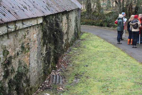
Tigh Vectican: This settlement was once a double cottage with its origins in the first half of the 19th century. The structure has undergone several phases of modification throughout its well-documented history; including a period in the early 20th century as accommodation for the casual sick. A Glasgow University (GUARD) report about Tigh Vectican can be downloaded here, written by Gavin MacGregor, Olivia Lelong and DJ Johnston-Smith. It provides some interesting detail into the history of the area and the settlement's development. Memories and oral history of living at Tigh Vectican were collected by the Arrochar, Tarbet & Ardlui Heritage Group.
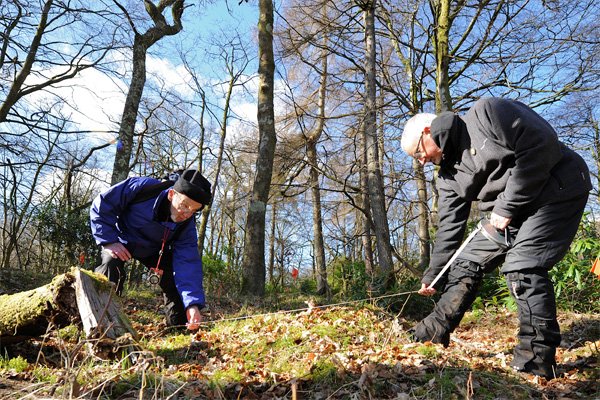
Creag an't Searraich: This settlement is noted as ruins on the 1st Edition Ordnance Survey map. The dwelling was ruinous in the mid-19th century, and low stone footings still survive today; it's probable that it dates to the 18th century. The Hidden Heritage project excavated the remains of the settlement. Check out the Results to see what was found.
Drove Routes: Throughout the Medieval period into the 18th century, routes used by drovers to move cattle to market flourished throughout Scotland. A drove route once crossed the isthmus and was used by drovers who journeyed south from the Western Isles to the trysts (markets) in Dumbarton, Crieff or Falkirk.
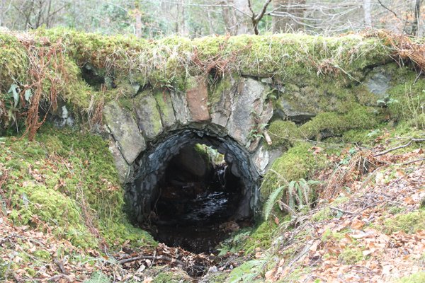
Military Roads: The route of the modern A83 between Tarbet and Inveraray via the head of Loch Long and Glen Croe was strategically important as a key route into Argyll. A military road was built here in the mid-eighteenth century by General Caulfield. Traces can still be seen running through Tigh Vectican behind the Cadet Centre. A lead pistol ball dated to the mid 17-18 centuries was uncovered during the excavations in Tarbet.
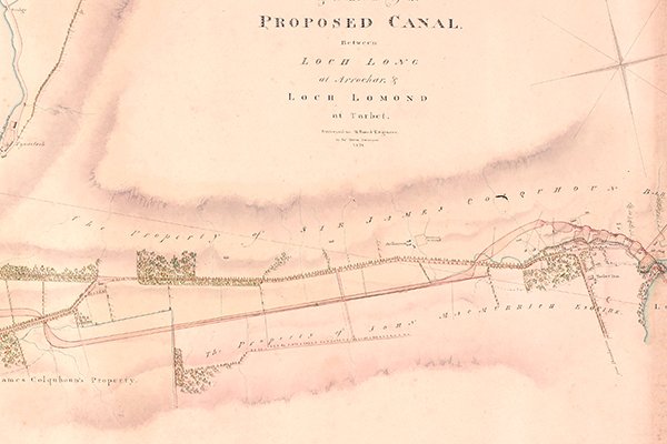
Canal: In 1821, a plan was drawn up for a proposed canal to join Loch Long with Loch Lomond. This emphasized the importance of the isthmus between Arrochar and Tarbet as a 'short cut' from the sea to the inland areas. Fortunately or unfortunately, the canal was never built. The survey for the canal was carried out by James Horn, for H. Baird, Engineer.
Toll Road: A 'Plan of the Road from the School House of Luss to Loch Longhead and of the Road from Tarbert to Inverarnan' as surveyed by Henry Reid was submitted in 1827, with a proposal to turnpike the road (i.e. turn it into a toll road). At this time, the road from Tarbet to Arrochar still followed the old route of the old military road.
Blog
Click on the link here to check out our Facebook page.
Events
Click here to find out about forthcoming events and how to get involved.
Timeline
Click here to see our timeline of events.
Location
Click here to find out where the Hidden Heritage Project is taking place.
Contact Us
Click here for our contact details.